Drone technology in environmental monitoring: a revolutionary tool
Drone technology in environmental monitoring enhances data collection, enables real-time insights, and aids wildlife conservation, while facing challenges such as technical limitations and regulatory hurdles.
Drone technology in environmental monitoring is changing how we observe and protect our planet. Have you ever wondered how these high-tech gadgets can help us? In this article, we’ll delve into their many uses in environmental conservation.
Understanding drone technology
Understanding drone technology is essential as it plays a vital role in modern environmental monitoring. Drones are not just flying cameras; they are equipped with advanced sensors and systems that provide critical data. This technology has revolutionized how we approach various environmental challenges.
What are Drones?
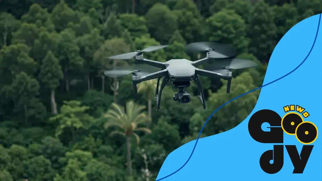
Drones, or unmanned aerial vehicles (UAVs), are aircraft that can fly without a human pilot onboard. They come in different sizes and designs, tailored for specific tasks. Many use remote control, while others operate autonomously, relying on GPS and onboard computers.
Key Features of Drone Technology
- High-resolution cameras: Capture detailed images for analysis.
- Real-time data transmission: Allows instant access to data collected during flight.
- GPS and mapping: Enables precise navigation and data mapping.
- Multi-sensor capabilities: Can be equipped with various sensors for specific tasks.
The versatility of drone technology makes them suitable for a range of applications, from agriculture to wildlife monitoring. For instance, aerial surveys can efficiently assess vegetation health and map habitats. Moreover, the ability to cover large areas quickly is a significant advantage, providing insights that ground surveys might miss.
As technology continues to improve, drones will become even more integral to environmental science. Increased battery life, enhanced payload capacities, and better sensors will expand their capabilities. Future developments may even include autonomous decision-making abilities, allowing drones to react in real-time to environmental changes.
How drones improve data collection
How drones improve data collection is a significant factor in the evolution of environmental monitoring. These devices enable scientists and researchers to gather vast amounts of data quickly and efficiently. With their advanced technology, drones can reach areas that are difficult or dangerous for humans to access.
Efficient Aerial Surveys
Drones can fly at various altitudes, allowing them to collect data from diverse perspectives. This flexibility means they can cover a larger area in a shorter time frame than traditional methods. Aerial surveys using drones often involve laser scanning, aerial photography, or thermal imaging.
One of the biggest advantages is that drones can gather detailed information about terrain, vegetation, and wildlife health. This data helps environmentalists monitor changes over time and assess the health of ecosystems.
Real-time Data Analysis
Another considerable benefit is the real-time data transmission. Using advanced sensors, drones can send information back to researchers instantly. This allows for prompt analysis and quick decision-making, which is crucial in time-sensitive situations like natural disasters or wildlife conservation efforts.
- Faster assessments: Immediate access to data speeds up investigative processes.
- Enhanced accuracy: Drones minimize human error in data collection.
- Cost-effective solutions: Reduces the need for extensive manpower and resources.
The integration of drone technology has also led to the development of specialized software. This software enables users to analyze the collected data more efficiently, providing insights that were previously unattainable. With these advancements, we are equipped to make informed decisions that positively impact environmental conservation.
Applications of drones in wildlife conservation

Applications of drones in wildlife conservation have become increasingly important as these devices offer innovative solutions for protecting endangered species and monitoring habitats. Using drones, conservationists can gather data while minimizing disturbance to wildlife, which is crucial for their survival.
Monitoring Animal Populations
One primary application is monitoring animal populations. Drones can cover vast areas quickly, providing up-to-date information about species distribution and numbers. This data is vital for tracking population dynamics and can help in making informed conservation decisions.
Habitat Mapping
Another significant use of drones is in habitat mapping. Drones equipped with high-resolution cameras can create detailed maps of ecosystems. These maps help researchers understand habitat structures and identify critical areas for protection and restoration.
- Visual assessments: Drones can capture images of hard-to-reach areas, assessing habitat conditions.
- Real-time monitoring: Immediate data collection allows for timely interventions when threats are detected.
- Minimized human impact: Drones reduce human presence in sensitive areas, allowing wildlife to behave naturally.
In addition to population monitoring and habitat mapping, drones are also used for anti-poaching efforts. By providing aerial surveillance, drones help authorities monitor protected areas and respond quickly to illegal activities. This application significantly contributes to the fight against wildlife crime, ensuring that endangered species receive the protection they need.
The integration of drone technology in wildlife conservation efforts continues to grow. As drone capabilities advance, researchers are finding new and exciting applications in conservation. The potential for drones to revolutionize how we protect and monitor wildlife is vast, making them an essential tool for a sustainable future.
Benefits of aerial surveillance for ecosystems
The benefits of aerial surveillance for ecosystems are vast and crucial for environmental monitoring. Drones and other aerial technologies provide comprehensive data that can lead to better conservation practices. This method allows researchers to observe ecosystems from above, offering insights that ground-level observations might miss.
Enhanced Data Collection
Aerial surveillance significantly improves data collection efficiency. Drones can cover large areas in a short time, gathering vital information about vegetation, wildlife, and land use. Researchers can quickly assess changes and trends within ecosystems, making it easier to identify issues that require immediate attention.
Real-Time Monitoring
One of the key advantages of aerial surveillance is real-time monitoring. Drones equipped with cameras and sensors can provide instant feedback on ecosystem health. This allows for timely interventions when threats, such as pollution or invasive species, are detected.
- Immediate data access: Aerial surveillance provides quick information during environmental crises.
- High-resolution imagery: Drones offer detailed images that are useful for tracking changes.
- Cost-effectiveness: Aerial methods reduce the need for expensive ground surveys.
Moreover, the use of aerial surveillance fosters collaboration among scientists, conservationists, and policymakers. By sharing data collected through aerial means, stakeholders can work together more effectively. This can lead to developing better strategies for protecting ecosystems.
As technology advances, the use of aerial surveillance will become even more valuable. New sensors and improved flight capabilities will enhance data collection and analysis, paving the way for more informed decision-making in conservation efforts.
Challenges in using drones for environmental monitoring
Challenges in using drones for environmental monitoring can impact the effectiveness of data collection and analysis. While drones offer innovative solutions, several obstacles must be addressed for successful implementation. These challenges range from technical limitations to regulatory hurdles.
Technical Limitations
One significant challenge is the technical limitations of drone technology. Battery life is often restricted, limiting the duration and range of flights. This means researchers must plan carefully to ensure they gather all necessary data within available flight times.
Data Management and Processing
Another issue involves the management and processing of the data collected. Drones generate vast amounts of information, which can be overwhelming. Proper software and tools are needed to analyze this data efficiently.
- Data storage: Large data sets require significant storage capacity and management.
- Processing speed: Analyzing data can be time-consuming, delaying decision-making.
- Technical expertise: There is a need for skilled personnel to handle complex data analysis.
Additionally, there are regulatory challenges that can hinder the use of drones. Compliance with aviation regulations varies by region, and navigating these legal frameworks can be complex. Obtaining permissions for flights in certain areas can also delay research.
Another challenge is ensuring safety and privacy. Drones flying over populated areas may raise concerns about privacy violations. Addressing these issues is crucial for gaining public trust and acceptance of drone technology in environmental monitoring.
Despite these challenges, the potential benefits of drones in environmental monitoring continue to make them an attractive option. Addressing these hurdles through innovation, collaboration, and education can enhance their effectiveness and acceptance in various environmental applications.
In conclusion, drone technology plays a vital role in enhancing environmental monitoring. The ability to collect data quickly and accurately has revolutionized how we observe and protect ecosystems. Despite challenges, such as technical limitations and regulatory hurdles, the benefits of using drones are significant. With continuous advancements in technology and data management, we can expect drones to become even more integral to conservation efforts in the future. By harnessing the power of drones, we can better understand our environment and take effective action to protect it.
FAQ – Frequently Asked Questions about Drone Technology in Environmental Monitoring
What are the primary advantages of using drones for environmental monitoring?
Drones provide quick data collection, real-time insights, and the ability to cover large areas efficiently, enhancing conservation efforts.
What challenges do researchers face when using drones?
Researchers face technical limitations like battery life, data management issues, and regulatory hurdles that can impact their monitoring efforts.
How can drones aid in wildlife conservation?
Drones can monitor animal populations, create habitat maps, and assist in anti-poaching efforts, all while minimizing disturbances to wildlife.
Is aerial surveillance with drones cost-effective?
Yes, using drones for aerial surveillance reduces the need for extensive manpower and resources, making it a cost-effective solution for environmental monitoring.


 adoption challenges every user faces")

